Wednesday, August 18, 2010

Pinched, Bitten, and Smeared

"I love fools' experiments. I am always making them." -Charles Darwin
"Uh, Dad, I thought you said they wouldn't bite?" "Ya, they try once in a while, but it doesn't amount to much." That was my reply to my daughter's question about whether the Northern Ring-necked Snake she was holding would bite. I was a few yards away turning stones over in Pachaug State Forest in Voluntown, Connecticut, looking for more snakes. I had found a Ring-necked Snake, and my daughter Janet and her friend Matt had been holding it and photographing it while I looked for more. "Well this one is doing a pretty good job of biting!" was her reply to my assurance not to worry. I stood up and turned around to see. Sure enough, that little so-and-so was doing his species proud.

Ring-necked Snake biting Janet's Hand
"Well don't worry about it. It won't even leave a mark." This was placating I know. Actually it did leave a mark, and it bit Matt as well. Son of a gun. It didn't bite me, and I caught it. You'd think justice would have been served and it would have taken revenge on the guy who caught it. Oh well, life is seldom fair.

Northern Ring-necked Snake (Diadophis punctatus edwardsii)
Matt holds a Ring-necked Snake.
It was a rainy Monday in August. Matt, Janet and I, were out looking for snakes and whatever else we could turn up. Matt loves snakes. And frogs. And Salamanders. And Lizards. Just to mention a few critters. Well so do I. Janet is game for almost anything. She may not get the thrill Matt and I get from finding snakes but she enjoys the woods and whatever it has to offer. Today we were getting wet and muddy while we explored, and we were getting smellier by the snake. Many snakes excrete a nasty smelling musk which they smear on an attacker, or a 12 year old, or a 51 year old who thinks he's 12. They also smear other unpleasant things on you as well, use your imagination, you'll get there. I know. Pretty disgusting. If you were picked up by a creature hundreds of times your size, you would do something similar. I know I would.

Why they are called Ring-necked Snake is pretty apparent.

This is a beautiful animal, the Northern Ring-necked Snake. Growing to only about 14 inches on average, the record length is about double that, 28 inches. They are usually found under rocks, logs, or leaf litter. It is easy to see why they are so named, a beautiful cream colored ring crosses the snake's neck dorsally. The belly is a rich yellow with a hint of orange. They usually don't bite people. Usually. These gorgeous little snakes eat salamanders, small frogs, other snakes, or even earthworms. Today both Janet and Matt would leave this snake with little bite marks on their hands. I'm pretty sure they felt they were little badges of courage actually. I was not bitten, did I mention that?

Matt with Garter Snake and Janet with Ring-necked Snake. Okay the Ring-necked is still attached by the mouth to Janet's hand. So it is sort of holding her actually.
My turning over rocks soon resulted in finding a small Eastern Garter Snake. This is certainly the most familiar snake to people in the northeast. They are the snake everyone finds in their yard at some point. I'm being judgmental here but I don't find them as attractive as the Ring-necked Snake. Still they are a snake, and therefore they are beautiful to me, and Matt. Janet was interested but not as impressed admittedly. Garter Snakes don't really bite either. They certainly can put on an impressively aggressive defensive act however. When they do bite, which happens sometimes admittedly, they can hang on tenaciously, like that Ring-necked Snake that was still attached to Janet's hand. I realized my credibility was running a bit low on this point, but Matt did not hesitate to take the snake from me.

Eastern Garter Snake (Thamnophis sirtalis sirtalis)
Eastern Garter Snakes are very common in many habitats. They grow to about two feet but have been found as long as 49 inches. The ones we found in Pachaug were small. They eat almost anything smaller than themselves but prefer mostly aquatic stuff, salamanders (I know! Salamanders just have it tough out there), frogs, and small fish. The second Garter Snake I found was about to shed its skin. When a snake sheds its skin it also sheds the specially adapted scales that cover its eyes. These scales turn a milky blue as the snake approaches shedding, or molting. If you find a snakeskin, look at the head, you'll see these eye scales are present on the shed snakeskin rather than holes where the eyes are. The photo below clearly shows these milky eye scales on this soon to shed snake.

The eye scale turns a milky blue prior to the snake shedding its skin.
The rain had pretty much stopped by now. Matt, Janet, and I decided to move on and explore other spots in the forest. We stopped at a forest stream with a large pool behind a man made dike. We poked around to see what we could find. One of the first things we turned up was a Crayfish. I don't know a great deal about Crayfish I must admit. There are about 350 to 400 species in the United States. Many are endangered due to habitat loss or degradation. They are also preyed upon by many species such as otters, raccoons, turtles, fishes, Rails, Herons, and of course, man. I scooped this one up using my bug net. The kids had to have the little guy pinch a stick (see the photo), but of course I had to have it pinch me. It grabbed my offered finger and hung on with amazing strength. I did want to have the kids see it didn't really hurt. I didn't, really. However, I think my "It won't... " credibility was still weak with the kids at that point.

Crayfish with stick supplied by Matt and Janet
Matt and Janet examine a Bull Frog
Matt quickly spotted something else in the water. He asked me what it was and I told him it was a dragonfly larva. I reached in and scooped it into my hand to show them. Specifically, it was a larva of the family Aeshnidae, or the Darners. These are the largest and fastest of the dragonflies in the northeast. The name "Darner" comes from the erroneous beliefs of people based on the long abdomen of the dragonfly and the way it lays eggs by pushing them into aquatic vegetation or rotten logs. Many misconceptions exist about these wonderful insects. They do NOT sting. They do NOT sew your mouth or eyes shut (for goodness sake!) They do NOT land on you and then bite. Okay they do bite if you hold one just right so it can get a bit of your finger right up against its mouth parts, but the bite does not hurt. I have let the largest of these bite me, the Swamp Darner, and while impressive in strength for such a light weight, it didn't hurt. The larvae of dragonflys are impressive little aquatic predators with large eyes and large mouth parts. This family's larvae stalk their underwater prey, using their large eyes and mouth parts, while many other dragonfly species larvae lie in camouflaged wait to ambush prey. When a dragonfly is ready to emerge and begin its flying stage, the larva will crawl out of the water on a rock or log and the adult will break out slowly, much like a butterfly. The dried larval skins left behind, or exuviae, can be found near the water's surface on vegetation, logs, rocks, or concrete culverts.

Aeshidae, or "Darner" Dragonfly Larva
Adult Aeshnidae. This is a female Lance-tipped Darner. It is possible that the above Larva is that of a Fawn Darner however, based on habitat and the presence of adult Fawn Darners egg-laying nearby.
The day was getting on, and Matt had to be back in time for a birthday party for his mom and sister. While we had time, I wanted to look for more snakes before Matt needed to be home, so we moved on. We next tried a couple of spots looking for Eastern Ribbon Snakes or Northern Water Snakes. I had seen an Eastern Ribbon Snake at one nearby location a couple days before, but it had eluded my capture. We looked today to no avail, but we did manage to find Northern Water Snakes.

Northern Water Snake (Nerodia sipedon sipedon)
Northern Water Snakes are frequently called "Water Moccasins" or Copperheads, by the uninformed, and are then pointlessly slaughtered. They are not Water Moccasins or Cottonmouths. They are non-venomous. They do have brilliantly white mouth linings and are vigorous biters in their own defense, but only in their own defense. This is a very common snake in Connecticut and they reach between 2 and 4 feet in length when fully grown. They will bite if handled without caution, and their mouths have a bacterial component that can cause an infection in the bite wound. This may be why the Greek name sipedon, or "infectious," has been used for this species. Northern Water Snakes will also use a convincing bluff to defend themselves. They will flatten their heads to approximate the triangular shape that is a feature of most of the venomous North American snakes. And let me tell you, when these snakes smear musk, or "whatever" on you, it really stinks! Just ask Matt and Janet. Using my bug net to reach out in the water, I snagged this little beauty.

Me holding the Northern Water Snake I caught using a bug net
Matt quickly took the snake from me after I warned that it would try and bite him if he wasn't careful. I told him his mom, Karin, would be less than happy with me if I let a Water Snake nail him! Matt is a brave young man and took the snake with no qualms. After a few pics, I put the snake back on the ground and it shot off back to the water, happy to be done with me. It had repeatedly struck at my camera while I photographed it, showing its white mouth lining. Northern Water Snakes prey mainly on frogs of the genus rana, such as Green Frogs. This is a subtly beautiful snake on its dorsal side, and a dramatically beautiful snake ventrally. The belly is patterned in reddish half moons or triangles.

Northern Water Snake
Dorsal view. Northern Water Snakes can be varied in color dorsally, this one is rather darkish. Take a good look, this is NOT a Cottonmouth or Copperhead! It is non-venomous but it is a "biter."
Trying to make you think it is venomous, a Northern Water Snake flattens its head. This is a defensive bluff however.
The beauty of the Northern Water Snake's belly
Having been pinched (me), bitten (Matt and Janet), and smeared (all of us), we called it a day. Dirty, wet, and smelly, we all headed off for a bite of our own. It had been a fun day despite the rainy start. The kids and I had found some pretty cool critters during our time in the forest. I love being able to share with children my love of the natural world, and Matt and Janet had clearly enjoyed themselves. I look forward to the next time I can be pinched, or bitten, or smeared! You should give it a shot too, it won't hurt. Well not too badly at least... it is worth it... really!

Sunday, August 15, 2010

Walk the Dark Sky

The Great Man is He Who Does Not Lose His Child's-Heart. - Mencius
One dollar. The fee for parking at Lowe's Store and hiking Lowe's path. When Lowe's Path  was first built in the 1870s, a nominal fee was charged for hikers who wanted to use it to ascend Mount Adams in the Presidential range of the White Mountains. Over 130 years later, on June 25th of 2010, I paid a nominal fee so my young friend Mark and I could do just that.

Starting Lowe's Path to Mount Adams
Hiking above treeline in the Presidentials has its risks
Mark and I have had bad luck on weather forecasts on our trips. So far, nearly every trip we planned saw a change in the forecast for the worse at the last minute. This trip had been the same. Our original plan had been to hike up to Gray Knob Cabin and spend the night and then climb Mount Adams and Mount Madison the following day. Now, with the morrow's forecast looking damp and in the clouds, we decided to climb the peaks this afternoon and evening. It would mean Mark's first night hike in the White Mountains.

Mark at the Trail Head
Lowe's Path starts in the Town of Randolph, New Hampshire, which lies on the north side of the Presidentials. Most of the trails leading up these northern slopes are maintained by the venerable and respected Randolph Mountain Club (RMC). This organization also operates and maintains several mountain shelters with colorful and history laden names. These shelters include "The Log Cabin," "The Perch," "Crag Camp," and "Gray Knob." Lowe's Path would take us past two of these, The Log Cabin and Gray Knob. We would be spending the night at Gray Knob after our hike.

The trip up started hot and buggy
It didn't take us long to realize the lower section of Lowe's Path was going to be hot and buggy this day. Everyone has heard of "Black Flies." Here in Connecticut we refer to them as "Gnats." Actually, Black Flies, as I understand it, is an appellation used for a number of Gnat species. Regardless of taxonomy, these little creatures are evil. Okay they're not evil, that's anthropomorphizing I admit. They just seem evil. They plagued Mark and me as we trudged up the lower slopes in the dank still air of a hot June day. I knew once we broke above treeline we would have a deliciously cool breeze, but till then we would be sweating buckets and feeding swarms of small black vampires. This made the lower hike less than usually pleasant, but the expectation of relief was kindled when we reached RMC's Log Cabin. Roughly two and a half miles up from the trailhead, we finally reached the Log Cabin and climbed in for a much anticipated break.

RMC's Log Cabin. Our first milestone on the hike up.
 We dropped our packs and relaxed for a bit. Mark can sleep anywhere, anytime. I envy that. While he power napped, I sat on the porch and ruminated. This was the fourth hike he and I had done together. He had impressed me on each one of those hikes. In some ways he was a better hiker than I was, but I had the advantage of experience and doggedness. It was the same the few times we had gone running together, he was undoubtedly faster than me but I could keep going longer than he could. I thought of these things on the porch of the Log Cabin, and I thought how much this young man had come to mean to me. He had become like a second son to me. His company was as enjoyable to me as the company of my own son, Ian. Well time was passing, it was already almost 5pm and we had quite a lot of hiking still to do, so I rousted Mark and we continued onward and upward.

Our first views on the way up
  Until we finally reached Gray Knob Cabin, our hike had been a long, muggy, buggy, walk upwards. Just before we reached Gray Knob the forest transitioned from mixed hardwood and spruce to mainly spruce. Gray Knob Cabin is situated at treeline on a northwest pointing spur of Mount Adams. It is run by a caretaker and hikers can stay on a first come first served basis. Hikers must bring their own food and should bring a sleeping bag. Pads and sleeping space are provided. Mark and I went inside and met the caretaker before dumping the gear we would not be taking up to the peaks. We also informed the caretaker that we would be hiking into the night and asked if it would be okay to return late. He told us it was fine but to be quiet and respectful of the other hikers who would undoubtedly be asleep then. He also looked a tad concerned about our being on the mountain in the dark. That was understandable, hiking above treeline in the dark does have its risks.


Approaching Gray Knob Cabin. Mount Jefferson is the peak behind Mark.

We stake out our sleeping spots in the loft
Having dropped our sleeping gear and food, we headed out and up. As Lowe's Path ascends the spur above Gray Knob Cabin, the cabin is lost  to view pretty much immediately and you really get the feel of being high and remote. I love that feeling, and starting upwards so late in the day meant we would have the slopes nearly to ourselves, another plus.

Starting up from Gary Knob. The cabin is just below the knob behind Mark.
Across Castle Ravine, Mount Jefferson and Castle Ridge.
The weather forecast for today had been for clear skies with clouds coming in the next day. Well the clouds were already here and looked threatening. I had hoped to hike under a nearly full moon tonight, now I was concerned about rain. Still we were prepared, and I hoped we could make the summit of Adams before dark. My original plan to also hike over to Mount Madison was looking unlikely at this point. I didn't mind getting back to Gray Knob at 10 or 11pm, but 1 or 2 am would be pushing hiking etiquette waaaaay past what the other hikers would think acceptable. So we pushed on for Adams and would have to do Madison on another day.

Approaching gloom. Looking northwest.
I have talked about cairns in previous posts. They are piles of stones used above treeline to mark trails and help hikers avoid getting lost in bad weather with poor visibility. Lowe's Path above treeline is also marked with cairns. The cairns here also had the added feature of large chunks of white quartz used as toppers. These white stones can actually seem to glow at night. This is an amazing thing to see, and very comforting as well since cairns can simply disappear into the gathering darkness of nightfall. Yet again do I tip my hat to the cairn builders.

Mark leans against quartz topped cairn


The trail looking back. The cairns are topped with quartz.
Lowe's Path approaching Mount Adams. Again notice the quartz topped cairns. These would appear to glow during the gloaming.
The light was failing and the clouds threatened. I really wanted to make the summit before darkness robbed Mark and me of the spectacular views afforded by Adam's summit. I don't know if there is a more spectacular view in the White Mountains than the one from that frost riven pinnacle. The trail leading there is an easy one on which to sprain or break an ankle, however, with much rock hopping to do. And the summit cone is a splintered pile of boulders that offer ample opportunity for injury, so haste must be balanced with careful foot placement.

In the distance Mount Lafayette and Franconia Ridge
Just below the summit cone of Adams,  Lowe's Path crosses the major Presidential trail called Gulfside Trail. This intersection of several trails is famously called "Thunderstorm Junction." It is not called that for no reason, this is one place you do not want to be when lightning sears the heavens. At Thunderstorm Junction, a huge cairn has been built. I call this the "Mother Cairn." We stopped at the junction for a brief rest and snack. We were on the homestretch now and looked to beat nightfall to the summit!

Standing next to the Gulfside Trail sign at Thunderstorm Junction.
Budding Thespian?
Mark and the "Mother Cairn" at Thunderstorm Junction
Break over, we headed for the summit. The summit cone is a pile of massive boulders as I said and Mark and I took slightly different paths to the top. Once there however we both marveled at the views. It was the gloaming, that time that is neither day nor night. But what light remained illuminated the glory of the Whites, particularly Mount Washington across the Great Gulf, Mount Madison to our east, and Mount Jefferson to our southwest. I can not describe the feeling of being on that pinnacle in the gathering darkness. I am not religious, but that experience was spiritual. It seemed as if we stood at the top of the world and looked down on it falling away in all directions. There is a religious society that actually considers Mount Adams to be sacred, and that some sort of divine event happened on its summit. I don't subscribe to that myself, but surely we should treat such special places as cathedrals of our natural world, and preserve them for eternity.

Mark goes for the summit of Adams
On the summit of Mount Adams. Mount Washington stands above the Great Gulf Wilderness and Mount Jefferson lies across Jefferson Ravine.
Mark and me on Adams summit
Mark looks out at Mount Madison. Below in the col is Star Lake and the AMC's Madison Spring Hut. In the distance to the left of Madison lies the town of Gorham.
Mount Washington autoroad snakes upwards on Mount Washington. Center left is Wildcat Mountain with its ski slopes visible in the failing light.
We stayed and soaked in the grandeur as long as I dared. I did not want to descend the summit cone in complete darkness. My promise to Mark's mom to bring him home safely still rang in my head. The velvet silence of night fell as we slowly made our way back to Gray Knob Cabin. I was amazed at how long we could still see as our eyes adjusted to the darkness. It was not until almost 9:30pm that we finally put headlamps on. By the time we reached the cabin it was 10pm. We had eaten a simple dinner on Adams summit but we took time to heat up some dessert before ending our day. We did this outside the cabin to avoid disturbing the hikers who had already called it a night. I had Mark call his mom to tell her we had made it safely down and then he went inside to sleep. I talked to his mom for a while and soaked in the beauty of the night with the mountain above. It had been another great day of hiking with this young friend of mine. We had walked the dark sky. Tomorrow we would go over to RMC's Crag Camp cabin to see it and say hello to the caretaker there who we had met earlier on the trail up from Randolph. After that we would head back home to Connecticut, but not before stopping at Woodstock Station for food and Pemi Pale Ale. Some things are sacred indeed.

We head back down in the dark.
Mount Adams in the night.

Sunday, August 1, 2010

In the Shadow of the Cat


A man who carries a cat by the tail learns something he can learn in no other way. - Mark Twain
Mark and me finally ready to head for the Cat.

May 7, 2010. Nineteen Mile Brook Trail trailhead. Mark and I were gearing up for a hike up to Carter Notch Hut and then to climb Wildcat Mountain. Something was missing however, Mark had forgotten his gaiters. You have to have gaiters if you are going to hike in the snow, and even though it was May we were going to be hiking in snow. Gaiters wrap around your lower leg and boot to stop snow from getting into your boots. If you get snow in your boots, your feet get wet. Wet feet in the cold can be very bad for your comfort and potentially your life. More likely however is your wet foot getting rubbed raw by your boot, and if you have never hiked mountain terrain with your feet blistering, consider yourself fortunate. So we went back to the AMC's Pinkham Notch Visitor Center to buy gaiters for Mark. It happens. I once went birding and forgot my binoculars. Okay, more than once, hard to believe but there it is. I guess I'll also add that I forgot to bring Nuttah MD with us this time. Well she was with us in spirit at least, providing inspiration.

Nineteen Mile Brook Trail

We would be hiking up Nineteen Mile Brook Trail and staying at the AMC's Carter Notch hut for the night. The original weather forecast of fine weather for days had gone sour and our plan to climb Wildcat Mountain the next day had to be modified to doing it today. So we would hike our gear to the hut, sign in with the caretaker, dump gear there to lighten our load, and climb to the summits in the afternoon. Wildcat Mountain has two summits that count as 4,000 footers, Wildcat A and Wildcat D. It also has a well known ski area. So off we went with Nineteen Mile Brook roaring and pounding with snow melt water.

Nineteen Mile Brook was more an angry river with the recent snow melt.

We were hiking during that awkward time of year in the White Mountains of New Hampshire, when Spring is happening down low but Winter has not yet surrendered up high. So we were a bit over dressed on the low section and started sweating with the effort and weight of our packs. We had over night gear as well as snow hiking gear such as snowshoes. At the trailhead we heard a few returning warblers singing, such as Northern Parula, but on top the snow would still be 3 to 5 feet deep. These little feathered marvels had traveled all the way from the tropics to be here, and we drove up from Connecticut to briefly share the trailhead with them by the side of NH Routte 16. On the other side of Route 16, Mt. Washington and the northern Presidentials rose above us, but today we headed east, into the shadow of the Cat.

Crossing the brook

 Nineteen Mile Brook Trail is an easy hike as far as White Mountain trails go. Still it was pretty warm, and we were overdressed, so we worked up a good sweat anyway. I had last walked this trail more than twenty years earlier, with my friends Mike and Cindy. Then we were headed out from hiking the Carter Range, which was now on our left hand as Mark and I climbed. On that hike down with Mike and Cindy I managed to stumble and do a complete somersault with a full pack. I had gotten a bit scraped up and almost slid into the brook, but I came up laughing. I still have to laugh when I think about it now.

We reach the junction with Wildcat Ridge Trail

I need to explain about "monorail," rotten monorail more to the point. Okay, so it snows in the mountains, you probably aren't surprised to hear that. It snows a lot. That snow gets pretty deep right? Winter hikers walk over that deep fresh snow, usually wearing snowshoes. When they do this they compact the snow on the trail, resulting in a sunken but hardened path. Now this compacted snow is still pretty deep, 3 feet or often more. So hikers keep traveling over this compacted trail all winter and it gets a harder and harder crust. Then Spring comes and snow starts to melt. But the compacted snow on the trail melts more slowly. So as the snow on the sides of the trail sinks and disappears, the hardened trail snow does so much more slowly. This results in the trail turning from a sunken path to a raised path above the surrounding snow. Hikers now have to walk this elevated snow hump, and we call it "monorail", like the elevated track of an actual monorail. So good so far, but all snow melts eventually, and it also melts from underneath. Melt water running underneath the monorail attacks it and the warmth of the earth also eats away at the monorail's underbelly. So the monorail gets weak, and then we refer to it as "rotten." When a hiker is walking along rotten monorail he will break through on some strides and his leg can fall in right to the hip. This sudden unwelcome "how-do-you-do" obviously stops you dead and sucks energy and the joie de vive right out of you. This event is called "post-holing", for obvious reasons. Hikers don't enjoy rotten monorail or post-holing. On the upper stretches of Nineteen Mile Brook Trail we ran into rotten monorail and Mark and I post-holed again and again. New experience for Mark, old one for me. There would be more to come later on the ridge climb.

The Carter Lakes lie in Carter Notch in the shadow of the Cat.

So we slogged and post-holed our way to the junction with Wildcat Ridge Trail. We would be taking Wildcat Ridge Trail upwards to the peaks, but first we needed to go to Carter Notch Hut and sign in and drop our extra gear. We dropped down towards the Carter Lakes of Carter Notch and the hut. The hut was on the far side of the lakes from where we were. The Carter Lakes are gorgeous crystal clear mountain pools. Wildcat Mountain rises nearly vertically for 1,000 feet on the south side of the lakes and the impressive Carter Dome rises on the north. Bounding the lakes on the east is an amazing wall of huge boulders, appropriately called the "Rampart." It looks just like a massive fortress wall right out of Tolkien's "The Lord of the Rings." The Rampart was formed by massive rock avalanches from both Carter Dome and Wildcat Mountain. It is an imposing and memorable sight that reminds us mere humans of the power and forces our world unleashes from time to time. It must have sounded like the apocalypse when that slide happened.

The "Rampart" on the far side of the Carter Lakes.
Looking south in Carter Notch. The base of Carter Dome. The large bowl right of center is where the stone that now forms the "Rampart" split and fell. The top the northern end of the "Rampart" is visible above the tree tops.

After Mark and I took a few moments to drink in the magnificence of our surroundings, we followed the trail that circled the lake to get to Carter Notch Hut. In winter, some of the Appalachian Mountain Club huts are open on a caretaker basis. Winter hikers can stay at these huts but they must supply their own food and cook stove. They also should bring a sleeping bag and pad even though there are bunks available. Carter Notch hut is one of these huts, and the caretaker in residence during our visit was Heidi. I know, I know, Heidi in the mountains, how ironic. I didn't bring it up. I figured I wouldn't be the first to do so and spared her another comment about it.
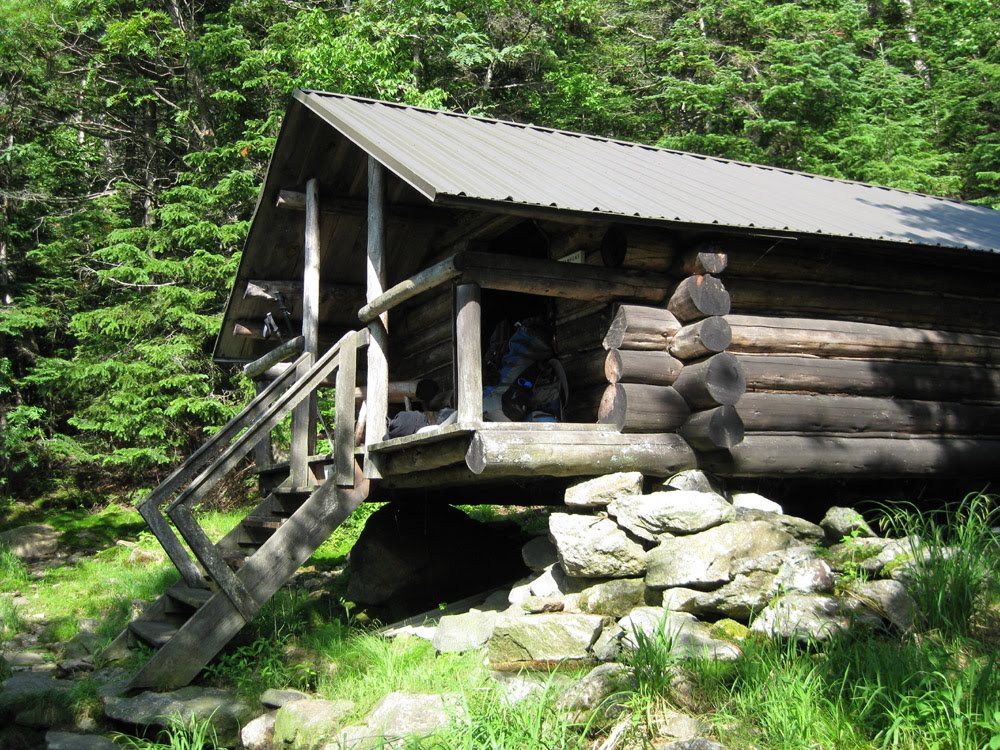
Carter Notch Hut
Mark and I introduced ourselves to Heidi and we chatted for a few minutes. We told her we were going up Wildcat Ridge Trail and were going to try for both Wildcat A and Wildcat D peaks that afternoon. It's good to let the caretaker know your plans in case something goes amiss, it never hurts to have more people aware for safety's sake. I should explain what a caretaker is I suppose. During the summer season all the AMC huts are fully crewed (hut crew call themselves "croo"), usually with young men and women. They run the hut, generally entertain a bit, and cook wonderful back country breakfasts and dinners for guests. They also partake in mountain rescues from time to time, these are not just any kids but are fine examples of young adults. During the off season, the caretaker huts have a single individual who watches over the hut and any winter hikers who wish to stay. This can be a lonely thing as you can imagine. Many nights see no one stay. It is not for the faint of heart, who need to be near civilization and other humans. Many nights are spent with no other company than the dark and the winter wind. And of course, your imagination. It reminds my of that line from "The Hobbit," when Beorn says to the dwarfs, "Heed no nightly noises." Ya, good luck with that! The "nightly noises" Beorn was warning about outside his house at night would have killed the dwarfs by the way.

Mark on bunk house porch

After our brief chat with Heidi, Mark and I headed over to the newly rebuilt bunk houses to drop gear before the hike up. We were very impressed with the lovely new bunk houses and bunks at Carter Notch. Being both teenagers at heart, Mark literally and me virtually, we both chose top bunks for night. We ridded ourselves of all the gear from our packs except for the things we would take onto the Cat.

Brand new bunk house and bunks.
There is no easy way to re-provision the AMC huts. So heavy loads are brought in by helicopter. At Carter Notch Hut there is no where to land a helicopter. So a helipad has been built on the top of the bunk house. The helipad is only inches wider than the helicopter's landing runners. The chopper pilot has to be good, has to be very good indeed!
  Once ready, we headed back around the lake to the junction with Wildcat Ridge Trail. It was getting on in the afternoon and we would have to make good time to get both peaks. As we headed up the trail however it didn't take long to realize we would not be making good time. Very early in the ascent we hit rotten monorail. Worse yet, the top of the monorail was eaten away at an angle. So the footing was treacherous and crumbly. Finding good footing as we climbed took time, too much time, and post-holing was not an infrequent event.

Spectacular view above the Carter Lakes
Mark post-holes right up to the hip. Not fun, and not making for fast hiking.
The monorail was very slippery in some areas as well. At one point I was standing still and talking over my shoulder to Mark when both feet shot out from under me. I fell off the monorail and landed hard on my side with my poles underneath. The poles were bent and so was my pride. Still I had to laugh, and moan a little too. Mark was concerned and quickly asked if I was okay. Certainly I had new bruises and pains I didn't have a few moments ago, but I was materially unhurt. I bent my poles back as best I could and kept going. The depth of the snow on this north facing slope was still 3 to 4 feet, making finding the trail more difficult. As we climbed higher, the snow bed was still intact and the monorail disappeared into a deep sheet of steeply angled hard snow across the Cats northern slope. No one had been on this trail recently, so there were no tracks to follow, and the height of the snow above the trail bed put our heads into the lower branches of the spruces that would normally have been over our heads. A few times we headed off the wrong way and had to backtrack to find the right way. Another danger in the mountains in winter is "spruce traps." A spruce trap is formed around the base of a tree or boulder in deep snow. The spruce or boulder will often warm the deep snow around it and melt it below the snows surface. This can lead to a large void around the tree or bolder that is invisible to anyone passing by until they step on the void's thin crust. The hiker (or skier) then breaks through and often is tumbled in head first, trapping them with their arms at their side. People die in spruce traps every winter somewhere in the US. I warned Mark about these traps and we found a few that were already opening up in the warming weather. We post-holed constantly but steered clear of any potential spruce traps.

A spruce trap open up in the warming weather

Mark inspects a spruce trap.

The angled snow cover we were hiking on had been softening and refreezing in the Spring thaw and was very slick. I was concerned for my young friend's safety, it would be easy to slip and shoot off into the broken and jagged spruce branches that adorn every trunk in the dark forest. So I started to kick foot holds in the snow's crust to reduce the chance of either of us slipping off and falling down slope into spruce "punjis". This further slowed our pace and tired me out considerably. Despite this precaution we both managed a few falls between frequent post-holes before we finally crested the ridge top.

A pose all too often taken. Mark after a fall.
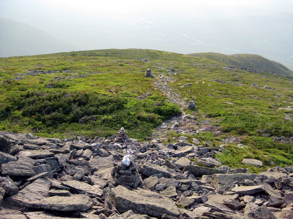
Much later than I had planned, we reached the top of Wildcat Ridge. Below us lay the Notch and the AMC hut nestled along the Carter Lakes. The Rampart was even more impressive seen from a thousand feet above. The mass of it was striking from on high. To our north lay the peak called Carter Dome. We took time to enjoy the views that unfolded before us, and to soak in the accomplishment of what had been the most difficult snow/monorail/post-holing I had ever encountered in the Whites. I was thoroughly beaten up and tired out. We would get the Cat's A peak today but I had no desire to slog the ridge all the way to the D peak this late in the afternoon and have to head down this slippery slope in the dark. So after hanging out for awhile and gazing at the beauty of Carter Notch and surroundings, during which Mark called his parents on my cell phone, we headed back down the ridge trail to the hut. Going down is always faster than going up, but you still have to be careful. Even more so since falling on the descent is usually worse than falling on the ascent.

In the shadow of the Cat. Carter Notch Hut and Carter Lakes seen from Wildcat Ridge. The Rampart is the broad mass of boulders to the right of the lakes.
Carter Dome lies across the notch.
Looking down Carter Notch towards Nineteen Mile Brook
Mark and me on Wildcat Ridge
Looking eastward. Maine lies in the distance.
Tired and bruised, we finally found our way back to the hut at dusk. We first went to the bunkhouse and dropped our packs. Then we gathered up our stove and food and headed over to the hut to make dinner. If you have ever eaten freeze dried trail dinners, you know they are not high cuisine. Their quality is immensely improved after a long hard hike however. Mark's mom had given me a new JetBoil stove for my birthday, so we christened it making dinner that night. The juxtaposition of my little backpacking stove next to the massive cast iron stove of the hut was comical. By the way, that hut stove came all the way up the notch in pieces on the back of superhuman porters who carried it all the way up from the trailhead on Route 16 many years ago. A mind boggling accomplishment that was beyond my mere mortal strength to perform!

The hut's stove. This massive cast iron beast came up the notch on the back of men. Supermen surely.

My JetBoil on the counter (with the little orange legs) is dwarfed by the hut's stove. The white bins below the counter are for food. This keeps food out of the bunk house. This is a black bear precaution.


Mark eats a found treasure, a Poptart left at the hut by a Boy Scout Troop while he waits for dinner.
After dinner we talked for some time with Heidi. It turned out she grew up just a few miles from our homes in Connecticut. It's a small world indeed. Mark clearly enjoyed the chance to learn from Heidi and to share his experiences with her. I was very happy he was enjoying himself so much. That is why I bring him on these hikes, and of course because he's fun to have around too. A bit later I told Mark he needed to make an entry in the huts journal. These books have been around for pretty much as long as the huts have and hikers have been recording comments and observations in them for decades. I knew Mark's mom would want Mark to add his voice to the hut's history.
 
Mark and I add comments to the huts journal. A shelf in the hut holds dozens of filled journals from the past.
 After dinner we called it a night and headed back to the bunkhouse. We stopped at the huts "facilities" on the way. You may have wondered about the "facilities." They consist of a rather large outhouse that actually has running water in the sinks in summer and toilets over composting pits. In the mountains, this amounts to luxury.

The outhouse is above the bunk house.
We settled in for the night in our respective top bunks. When we turned our headlamps off we experienced the total darkness of the mountains. I love it. So heeding no nightly noises, we slept the night away. Morning found fog and rain pounding the bunk house. The temp outside was 34 degrees. The decision to climb the ridge yesterday afternoon was a good one clearly. We headed over to the hut to make breakfast and hang out till a break in the heavy rain hopefully occurred. We found Heidi getting ready to hike out to meet  a  friend who would be hiking back in with her later in the day. We said our goodbyes and Mark and I had the hut to ourselves for a leisurely breakfast.

The breakfast table.
  Eventually the rain lessened. So in fog and moderate rain, Mark and I said goodbye to Carter Notch and headed down. The hike out was unremarkable but wet and muddy once below the remaining monorail. Hiking in the rain and mud made for a seemingly long trip out but we finally reached the trailhead and gratefully climbed into the shelter of my truck. Off we went for quick showers at the AMC Pinkham Notch Visitors Center and then do the long drive home to Connecticut. Mark had another peak on his resume and he had his first hut experience. Once again I had enjoyed his company and his hiking toughness. It had been a fun couple of days in the shadow of the Cat.